Home
Leeds FAS2 General Information
What is the Leeds FAS2?
 A vegetated reinforced earth embankment at the Tannery site
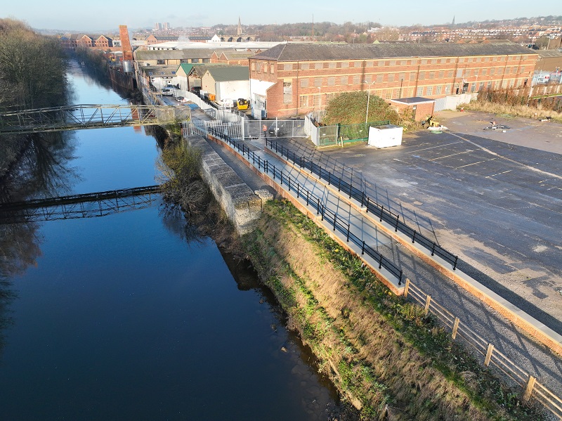
 Progress on flood defence walls in Kirkstall from November 2022
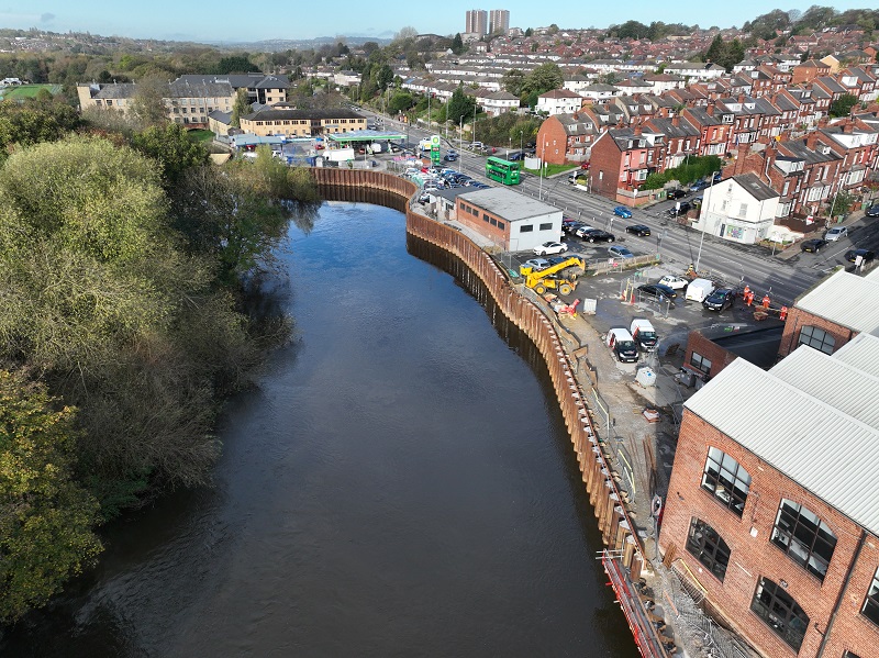
 Progress on the flood defences at Cardigan Fields Retail Park in March 2022
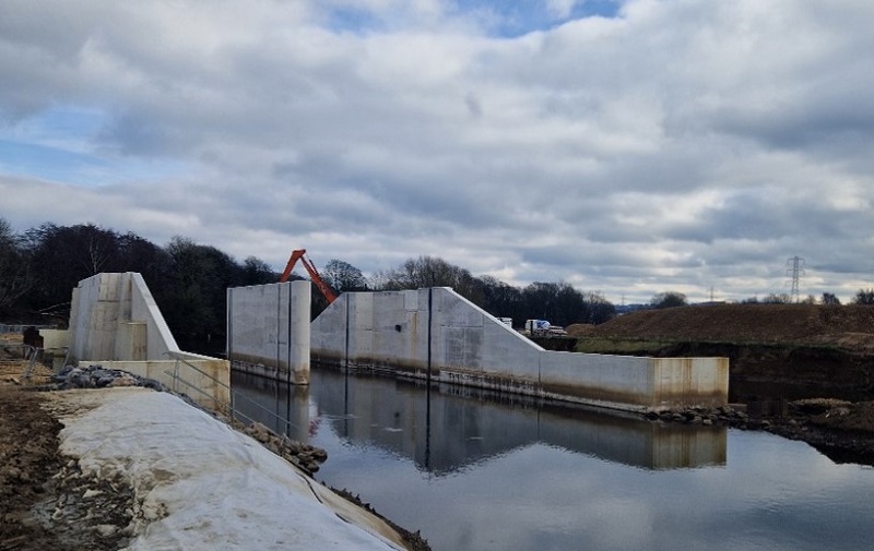 Progress on the Flood Storage Area in Cragg Wood from February 2023
Following the completion of the first phase of the Leeds Flood Alleviation Scheme, Leeds City Council are working with the Environment Agency on the second phase of the scheme to reduce the risk of flooding across Leeds, using a catchment-wide approach.
The Leeds Flood Alleviation Scheme Phase 2 (Leeds FAS2) is a two-part scheme that aims to reduce flood risk and provide better protection for 1,048 homes and 474 businesses along the river Aire corridor between Leeds City Station and Apperley Bridge using a combination of natural flood management techniques and engineering works.
The scheme involves:
- New flood defence walls and embankments
- New flow control structures and pumping stations
- A large flood storage area near Calverley, making use of an existing flood plain.
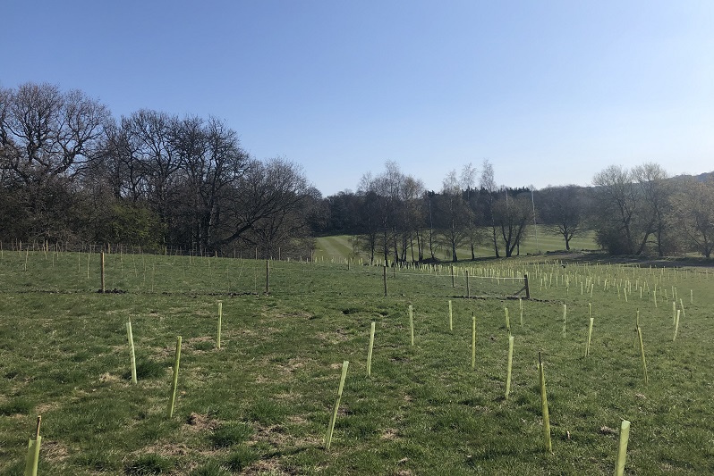
- A natural flood management programme. This will help reduce and control the flow of rainwater into the river using natural techniques, such as tree planting.
- Removal of obstructions along the river to reduce water levels
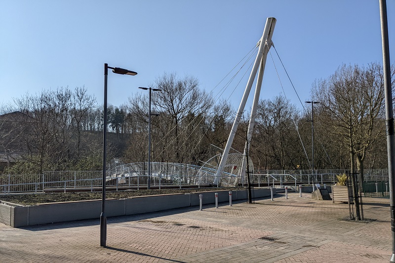
- Local access enhancements including two new bridges and improved footpaths and ramps, subject to planning permission and further funding being available.
Leeds FAS2 will provide a one-in-200-year level of protection against flooding in the Leeds FAS2 area. This means the scheme will reduce the risk of flooding to a 0.5% chance of occurring in any given year, including a climate change allowance. Once delivered in full, the scheme will protect against a similar event to Storm Eva on boxing day 2015.
The Leeds FAS2 is planned for completion by Autumn 2024.
Why do we need the Leeds FAS2?
 Flooding at Kirkstall Bridge on Boxing Day 2015. Credit: Ross Parry Agency
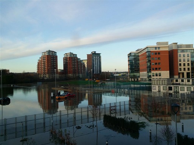 Flooding at Wellington Place on Boxing Day 2015. Credit: John Bleakley
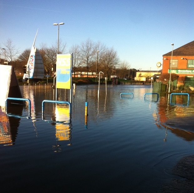 Flooding at Cardigan Fields Retail Park, Kirkstall on Boxing Day 2015. Credit: Nick Hunt
Wetter winters, drier summers and increased rainfall linked to climate change means that many parts of the country—including Leeds—will become more likely to flood over time.
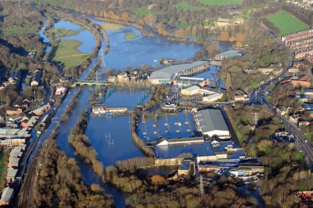
The area covered by Leeds FAS2 has already experienced severe flooding, most notably on Boxing Day 2015, following Storm Eva.
Storm Eva brought extreme rainfall and gale force winds to Leeds, which led to major disruption across the city and in the wider area, including Apperley Bridge, Bradford.
The A65 Kirkstall corridor, where part of the works for Leeds FAS2 are taking place, was heavily flooded from the river Aire, resulting in major road closures, damaged utilities and flooding in homes and businesses.
After this devastating event, Leeds City Council presented proposals to government in partnership with the Environment Agency, aimed at reducing flood risk upstream of the city centre, whilst also increasing the standard of flood protection provided by the already complete Leeds FAS1 works in the city centre.
Following these discussions, a two-step approach was agreed, with an initial £87 million secured from central government, for Leeds City Council and partners to progress with Step 1.
In early 2021, an additional £21million allocated to the scheme was secured for Step 2.
Where are the Leeds FAS2 works taking place?
Leeds FAS2 focuses primarily on developed areas along the river Aire, upstream of Leeds City Station to the Apperley Bridge area:
Leeds FAS1 and FAS2 are made up of 15 zones, allowing us to simultaneously develop detailed designs in some areas and commence construction in others. Leeds FAS2 encompasses zones 10-15, due to the way that the project was funded, those zones have been grouped into two steps, both of which need to be complete before the 1-in-200 year level of protection will be provided:
- Step 1 (zones 10 – 13) – runs along an 8km stretch upstream of Leeds station, along the A65 Kirkstall corridor. Our works largely consists of raised flood walls or embankments in the Kirkstall area. Construction works relating to this step began in January 2020
- Step 2 (zones 14 – 15)- comprises a flood storage area near Calverley and flood walls in the Apperley Bridge area
- You can find out more about each zone by navigating the map above, or by visiting our Leeds FAS2 Engineering Updates page
There is also a flagship natural flood management programme taking place upstream of Leeds across the River Aire catchment, find out more about the scheme, which is the first of its kind.
Watch a flythrough video of Phase 2 of the Leeds Flood Alleviation Scheme in full along the river Aire.
Additional benefits of Leeds FAS2
 Tree planting at Bodington Fields
As well as providing an improved level of flood protection, the scheme will:
- Support the city’s efforts to tackle the climate emergency
- Support regeneration and future development opportunities
- Improve biodiversity and water quality
- Increase employment
- Provide volunteering opportunities along the river
Volunteer tree planting in Hawksworth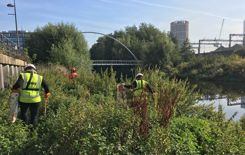
Members of the FAS2 Team Volunteering with the RSC
How you can get involved
We are committed to engaging with affected residents and businesses during the development and delivery phase of this project. You can get involved by:
- Arranging a video call with our project team
- Signing up to our newsletter
- Visiting our twitter page @LeedsFAS
We can be contacted about anything to do with Leeds FAS2 by telephone or email:
- Tel: 01651 267003
- Email: lfas@leeds.gov.uk