Home
Middle Wharfe Catchment Flood Risk Study
Middle Wharfe Catchment Flood Risk Study
Find out how our Flood Risk Study will identify solutions to lower the risk of flooding to properties in the Middle Wharfe Catchment.
Why Wharfedale needs flood protection

[Flooding in Collingham from 2019]
[Photo credit: John Bleakley]
Areas of Wharfedale have experienced severe flooding in the past, notably in 2015. Communities that have been affected include:
- Collingham
- Wetherby
- Thorp Arch
- Boston Spa
- Linton
Information on mapping and modelling flood risk
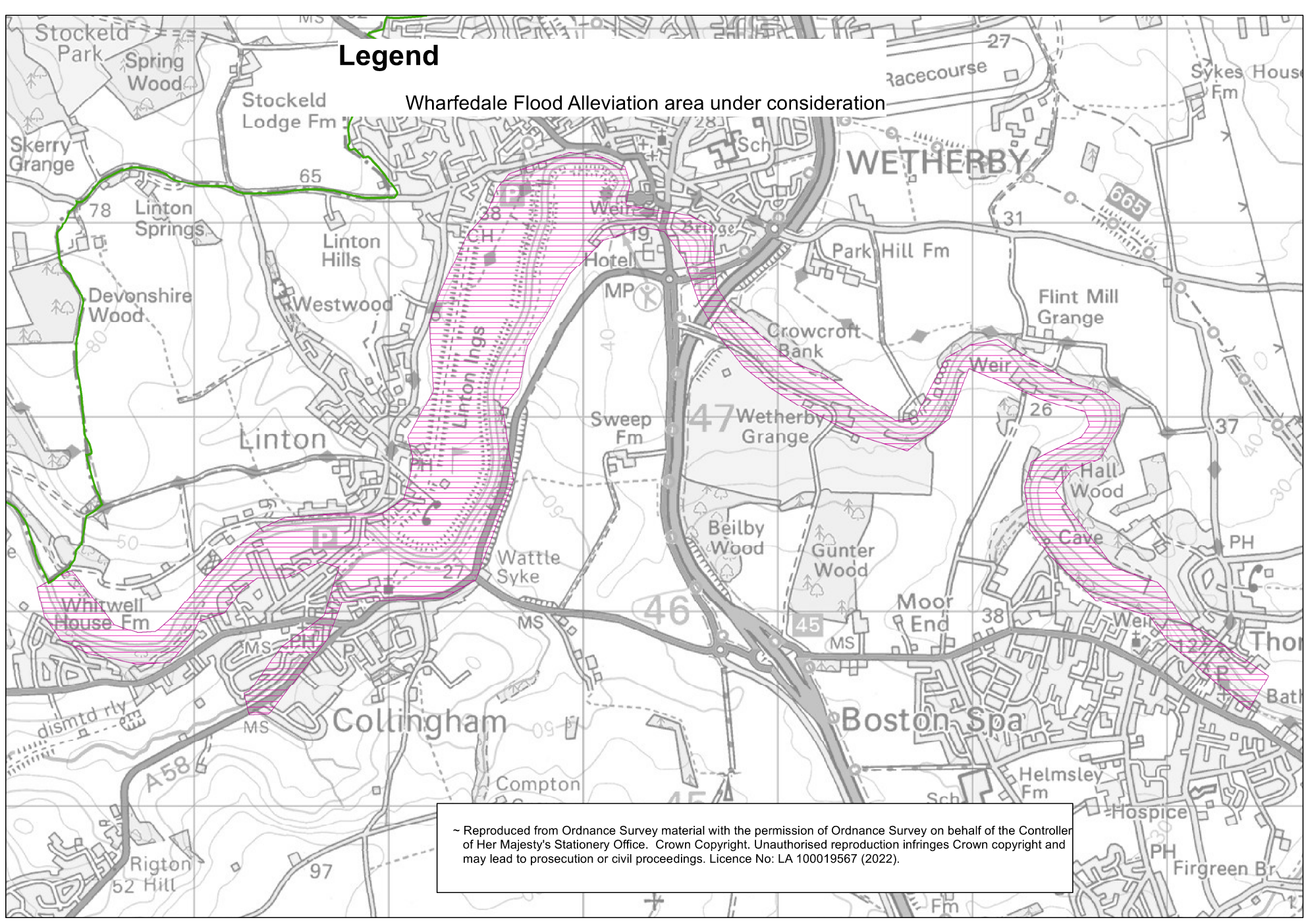
[The area of the Middle Wharfe Catchment under consideration]
Leeds City Council’s flood risk management team are currently working with the Environment Agency to assess the flood risk in the area through various mapping and modelling tools.
This process is complicated and time consuming. It requires many different types of data, including topography, bridges, inlets and outlets, channel roughness, and more. It also assesses large geographic areas, as what happens upstream on a watercourse has impacts downstream - The river Wharfe catchment stretches right up into the Yorkshire Dales beyond Appletreewick and Conistone – with conditions there having an impact all the way down to Leeds.
Once collected, these datasets combine to produce a baseline model of the area on a computer system. The baseline model allows us to project how defences like walls, embankments and similar would perform in reality. The large size of these data sets, and the huge number of actions that we could take, means that it takes a lot of time and processing power to find solutions that will reduce flood risk in the area. The solutions need to provide a suitable level of flood risk reduction whilst also being environmentally friendly, community friendly and financially viable. The effects of climate change also need to be factored into the model to ensure that we develop projects and schemes that can adapt to increased rainfall and higher river levels.
Progress on the flood risk study
At our engagement session in Wetherby Town Hall held in September 2021, we gathered a range of useful information from residents that has been used to verify our model. The first-hand experience of how flooding occurs in the area from those who live there is incredibly useful to this process. In September 2023 we published a newsletter outlining responses to various comments and questions that we received throughout the baseline modelling process - read it here.
Now that we have undertaken the modelling up and down the catchment, and factored in the insight from the community, our baseline model is complete and once this has been approved by the Environment Agency, it will enable us to enter the next phase of works.
Next Steps
The next phase of work is to understand the flood risk benefits of a range of options in the area, to model their benefits independently, and in various combinations. This will inform the potential for a flood scheme.
This phase of work is currently planned for completion in summer 2024, where we will be arranging another engagement event, like that of September 2021.
We will be providing another update on our progress with the modelling in Spring 2024.
Contact us
Sign up to our Middle Wharfe Catchment mailing list for regular updates on project process.
For any more information, please email us at FRM@leeds.gov.uk and include ‘Middle Wharfe Catchment’.