Home
Potternewton Flood Risk Study
Potternewton Flood Risk Study
Find out how we’re lowering the risk of flooding around Potternewton Park with our flood risk study.
Why Potternewton needs flood protection
[Flooding in Potternewton Park in 2021]
The area around Potternewton floods because the drainage system is not able to cope with the amount of water after heavy rain. This creates surface water runoff leading to flooding of properties as well as flooding from the sewer network. Properties here were flooded in 2007 and 2010, there is also frequent flooding of highways and Potternewton Park. We’re working with Yorkshire Water to reduce the risk of flooding after heavy rain.
The areas that are most at risk of flooding are on Newton Road and to the southwest of the park.
What we’re doing to reduce the risk of flooding
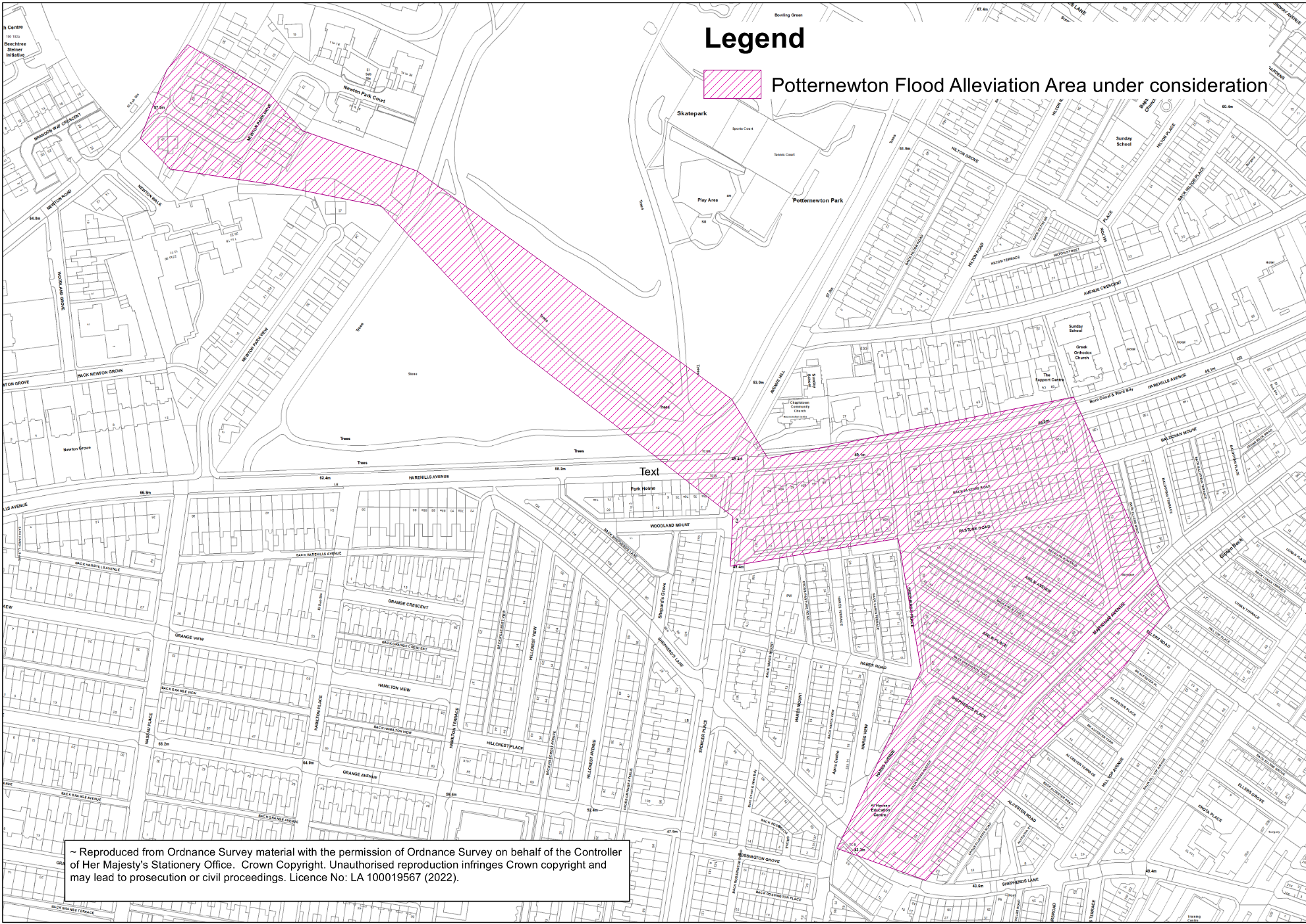
[A map of the area we are considering as part of our study]
We’re working with the Environment Agency and Yorkshire Water to assess the best way to reduce flooding.
Once we have identified any viable solutions, we will be consulting with local residents, landowners and the wider public on our plans. This consultation will take the form of an online survey on Commonplace, and face to face sessions with local residents, businesses and community groups.
Contact us
Sign up to our Potternewton mailing list for regular updates on project process.
For any more information, please email us at FRM@leeds.gov.uk and include ‘Potternewton flood risk study'