Home
Thorner Beck Flood Risk Study
Thorner Beck Flood Risk Study
Find out how we’re reducing the risk of flooding to properties from Thorner Beck with our flood risk study.
Why Thorner Beck needs flood protection
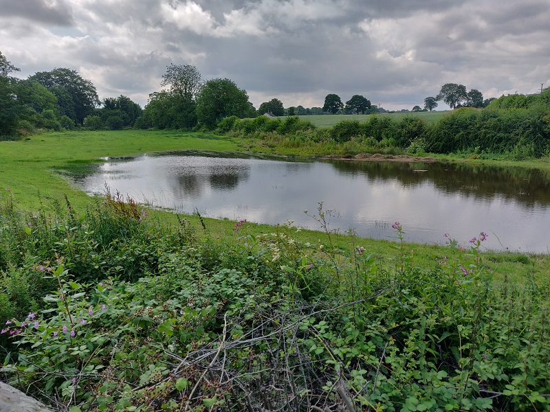
[An area prone to flooding from Thorner Beck]
There have been major flooding events in the past from Thorner Beck, particularly in 2007 affecting Mexborough Court and Main Street in Thorner.
What we’re doing to reduce the risk of flooding
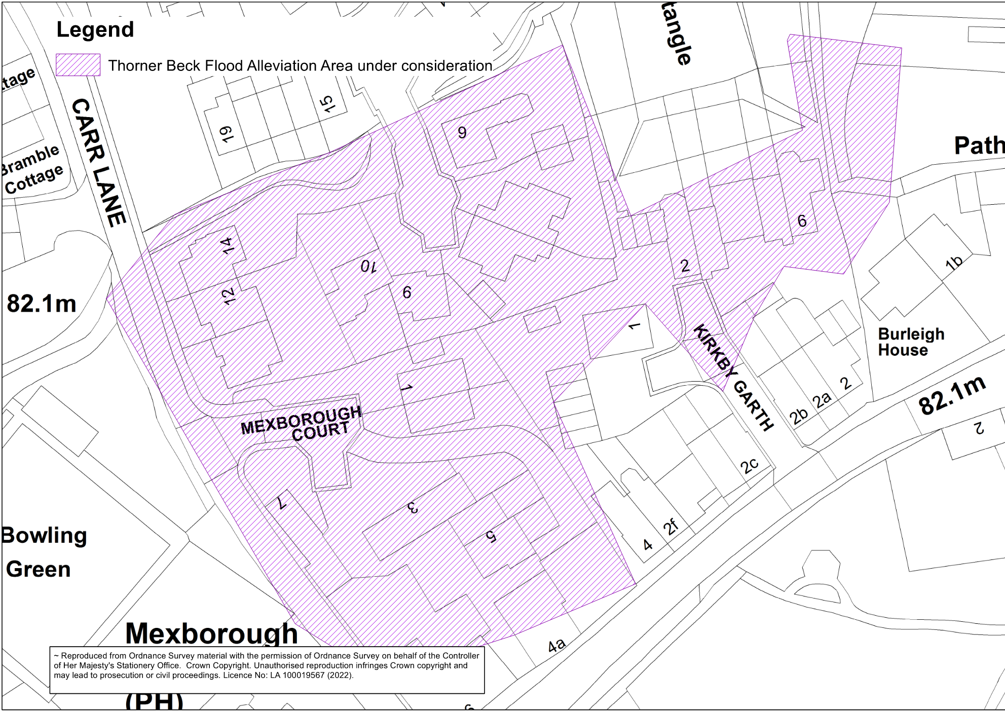
[The area of Thorner that this study is aiming to protect]
A study of Thorner Beck has been completed by the Environment Agency to update flood mapping in the area. This model is being used by Leeds City Council to develop a scheme to manage flooding. The initial phase of the project is to review the modelling and identify the most suitable solution for a flood scheme.
Potential options for the scheme include flood storage upstream of the Westfield Lane Ford. Other Natural Flood Management measures in the catchment will also be considered.
We are also working closely with the Yorkshire Dales Rivers Trust, who are currently delivering a project to improve water quality in the Thorner Beck catchment. This work includes tree-planting, work with farmers and local improvements to re-naturalise areas of the channel.
Surveys and Traffic Management - W/C 29/1/24
As part of this study, the Leeds City Council Flood Risk Management team will be conducting topographical and ground investigation surveys at various points along Thorner Beck adjacent to Main Street and further upstream adjacent to Lower Sandhills.
Lane closures on Main Street and Lower Sandhills are needed to allow machinery access for the ground investigation works. Pedestrian routes and access for residents will be maintained throughout.
Phase 1 (w/c 29/1) comprises of the closure of the northbound lane of Main Street between Westfield Lane Ford and Lower Sandhills, with temporary 3-way traffic lights in place to allow access into St. John’s Avenue. The bus stops near to St. John’s Avenue will be suspended during this phase – this will last for approximately one week.

Phase 2 (w/c 5/2) comprises of temporary traffic lights and the closure of the southbound lane of Lower Sandhills from the Cricket Club to the bridge over Mill Beck and subsequently the northbound lane – this will also last for approximately one week.


Contact us
Sign up to our Thorner Beck mailing list for regular updates on project process.
For any more information, please email us at FRM@leeds.gov.uk and include ‘Thorner Beck flood risk study'.