Home
Wortley Beck Flood Risk Study
Wortley Beck Flood Risk Study
Find out how we’re lowering the risk of flooding to properties from Wortley Beck with our Flood risk study.
Why Wortley Beck needs flood protection
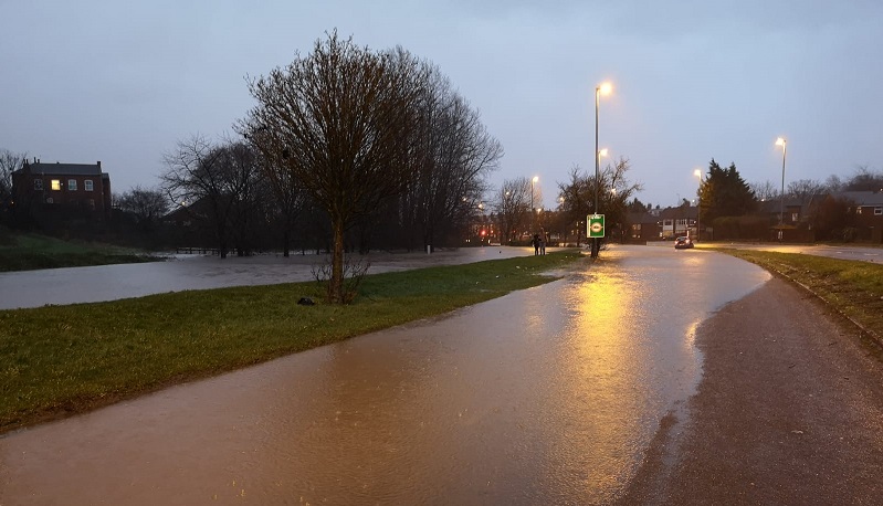
[Flooding to the A6110 Ring Road from Wortley Beck in 2020]
[photo credit: Gary Derbyshire]
There have been frequent flooding events from Wortley Beck (also known as Farnley Beck and Hol Beck) most notably in 2007 and 2015. There are over 50 properties in the catchment known to have been affected by internal flooding and 200 properties within Flood Zone 3. There was also recent flooding of the outer ring road in February 2021 and February 2022.
What we’re doing to reduce the risk of flooding
Leeds City Council’s flood risk management team are currently working with the Environment Agency to assess the flood risk in the area through various mapping and modelling tools.
In September 2022 we were able to identify a long list of possible interventions that could reduce flood risk in the area.
An initial round of consultation was undertaken on the long list of options. The responses to this consultation were incorporated into further modelling. We collated the responses into common themes and responded to those who signed up to our mailing list in February 2023.
Since the consultation, we have been analysing the feasibility of the potential solutions. The process of developing a scheme that is both effective and affordable is complex and time consuming. The Wortley Beck catchment is vast, and as such there are several options for interventions that we have considered. Testing all these options independently, and in various combinations with each other, to find the optimal solution requires a huge amount of processing.
The modelling for the different variations and combinations of the options will be completed in early 2024. After this we will be able to create a new shortlist of options.
Contact us
Sign up to our Wortley Beck mailing list for regular updates on project process.
For any more information, please email us at FRM@leeds.gov.uk and include ‘Wortley Beck Flood risk study'.