Home
Leeds FAS2 Engineering Works Updates
Find out about our current and upcoming flood alleviation works
In this section of the website, we will keep you up to date on the progress of the Leeds Flood Alleviation Scheme phase 2 (FAS2) throughout the construction of the engineering works.
You can find out more information on the scheme on our Leeds FAS2 General Information page.
We have split the Leeds FAS2 into 12 zones which are shown on the below map:
You can navigate to information on each zone from the map or read through zone by zone below.
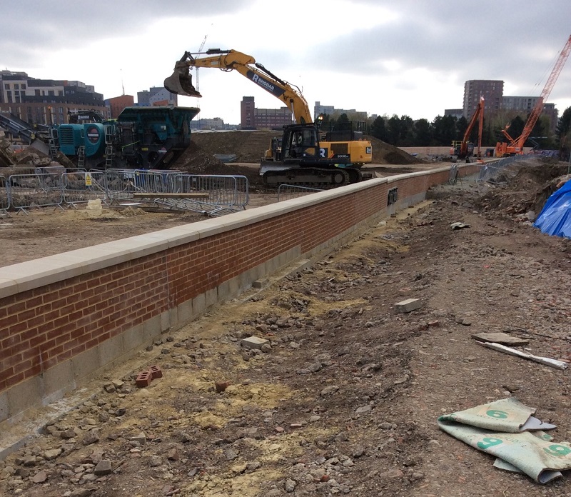
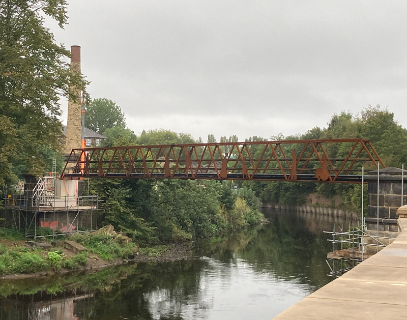
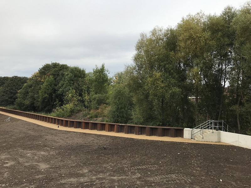
Zone 10: Leeds Train Station to Wellington Road
Overview
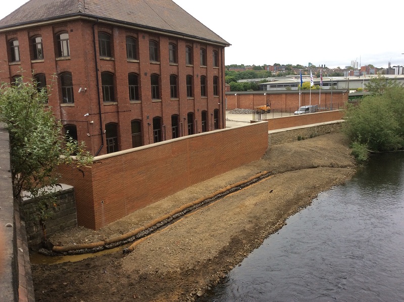
Works in zone 10 stretch from the north of Leeds City Station to Wellington Road.
There were no existing flood defences in this area prior to Leeds FAS2.
The works in this zone are now largely complete, with only some minor works on outfalls, and vegetation growth remaining.
The works consist of masonry clad reinforced concrete, and exposed steel sheet pile flood defence walls up to 1.2 metres in height with the latter to be later incorporated into developers’ landscaping works.
As part of the environmental enhancement and mitigation to be provided by the scheme, floating riverbanks have been installed, by No.1 Whitehall Riverside. These installations are floating ecosystems, softening the riverbank wall, as well as providing a habitat for plants and wildlife.
 Completed flood walls at the former Yorkshire Evening Post site
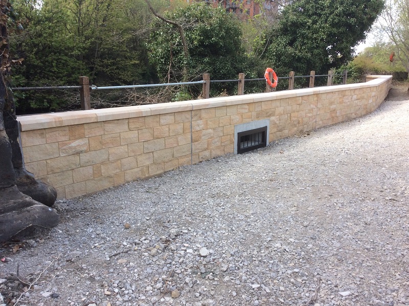 Completed flood wall at Wellington Place
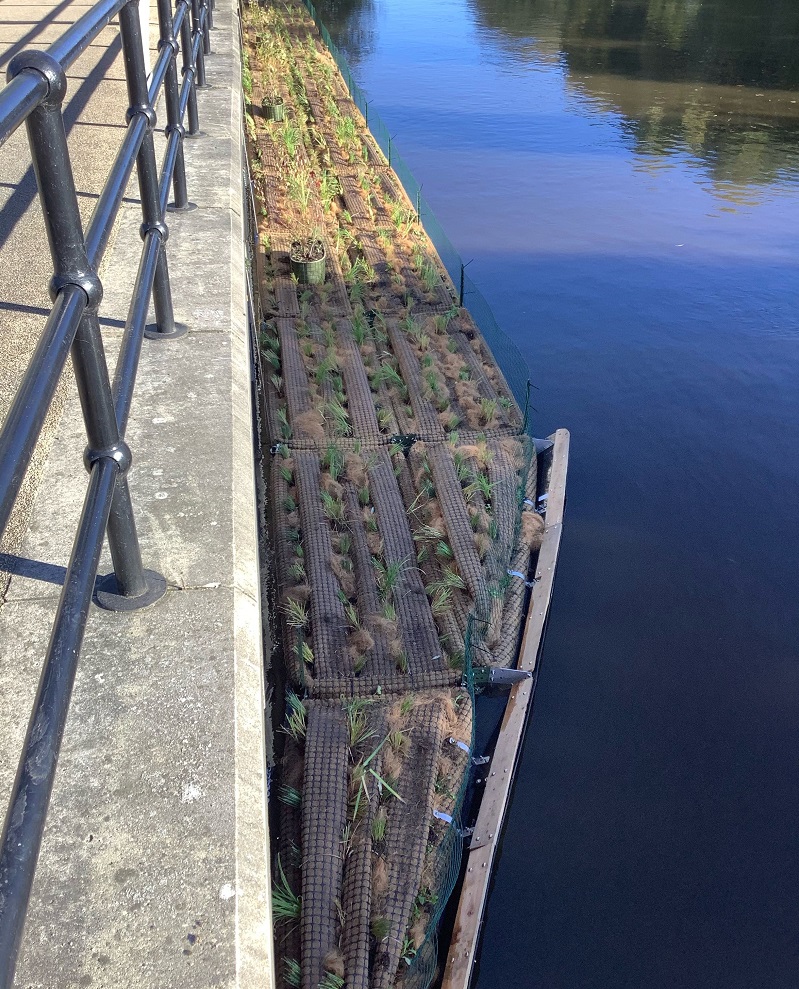 Completed floating riverbank
- In December 2021, we created an access route through Wellington Place and completed sheet piling on the former Yorkshire Evening Post site.
- Finishing works to install a timber cap to the sheet pile wall at the former Yorkshire Evening Post site were completed in February 2022.
- The flood walls in this zone were completed, and the site was handed back to developers in June 2022The floating riverbanks were installed in October 2022.
Page last updated 29/2/24
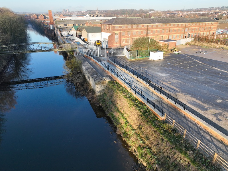
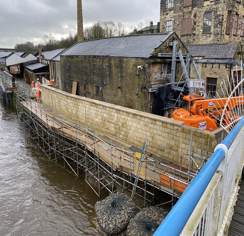
Zone 11a and 11b: Wellington Road to Viaduct Road
Overview
Works in zone 11a and 11b stretch from Wellington Road to Viaduct Road. This stretch of riverbank is occupied by several businesses including factories, offices, and warehouses along the Kirkstall Road corridor. It also contains the site where our project offices are based.
Works In this location involve raising the level of the left riverbank and constructing a combination of reinforced concrete walls, cladded with brick, and installing steel sheet piles.
Some of the flood defences will be set back from the river to allow for future riverside access.
In a location adjacent to eChem we are constructing a sheet piled wall in the river channel to defend the business against flooding.
At Burley Bridge Mills it is not possible to work inside the building to strengthen the riverside elevation so this will be done by working externally from the river channel.
We are also carrying out work to around a hundred openings in the existing river side wall that are either live drainage outfalls or redundant historical outfalls so that they are sealed against raised river levels.
Works here are part funded by the European Regional Development Fund.
Construction in Zone 11 is ongoing but will not be complete until the end of the project in 2024, as our project offices currently occupy the footprint of one of the planned interventions.
Completed Works
 The vegetated reinforced earth embankment at the Tannery site
 Sheet piling adjacent to eChem with planting at the foot of the piles and space for planting at the top
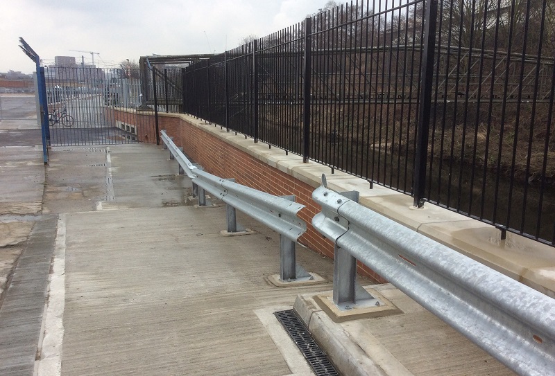
Completed works at the HFH site
Completed flood wall at the former Studio 81 site
Completed flood defences at NIC Services
 Completed flood defence wall at our former site compound on Viaduct Road
- Flood defence walls have been completed in between Wellington Bridge and Washington Street
- Strengthening of existing building elevations at Aire Place Mills has taken place to allow them to act as an effective flood defence
- A sheet piled flood defence structure has been installed in the river channel adjacent to eChem
- A section of collapsed 4m high riverbank adjacent to The Tannery has been rebuilt with a vegetated reinforced earth embankment – a nature-based solution, which is low in carbon, improves the riverside habitat and is nicer to look at than traditional engineering techniques
- We’ve installed an otter ramp & steps over our flood defence wall by the section of the river behind the City Reach development site. This allows otters to climb the vertical river wall, especially when the river is in flood
- Works at the Holliday Fielding Hocking (HFH) site are now complete, and the area has been handed back to the owners
- Works on the SFS site are now substantially complete.
- Works to strengthen the riverside elevation of Burley Bridge Mills are now complete
- Works at eChem are now complete. As part of our ongoing efforts to incorporate the natural environment with our flood defence assets, we have installed planters at the top of the sheet pile wall. Landscape planting will be carried out in 2023.
- Works at the former Studio 81 site to install a flood wall are now substantially complete, allowing the developer to continue with their construction.
- We have completed our works at the NIC Services site. We have successfully handed the site back to the landowner.
- We have now completed all works at our former site compound at Viaduct Road.
Page last updated 27/3/24
Zone 12a: Armley Mills Industrial Museum
Zone 12a focuses on Armley Mills, which historically served as one of the world’s largest woollen mills and is now the site of Leeds Industrial Museum.
Overview
Armley Mills has historically been impacted by floods and experiences low level flooding every three to five years. Recent large-scale flooding (including the 2015 Boxing Day floods) has resulted in significant issues, including loss of power and long-term damage to historic areas and exhibits.
The works being delivered at Armley Mills are:
- Flood defence walls between 0.8m and 2.1m with cladding that will blend into the existing industrial setting of the museum
- The replacement of the pipe bridge, formerly the historic access to the mill, as the current structure is restrictive to water flow. It will be replaced with a service line bridge with the appearance of a footbridge
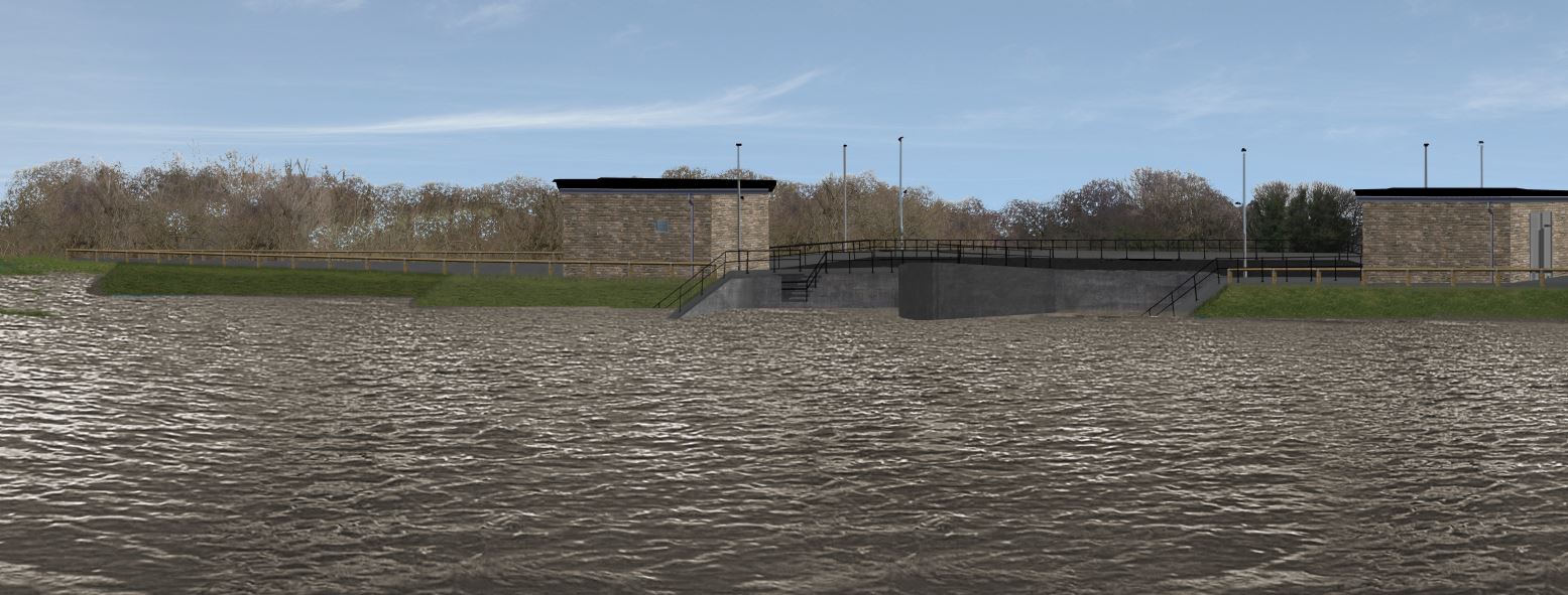
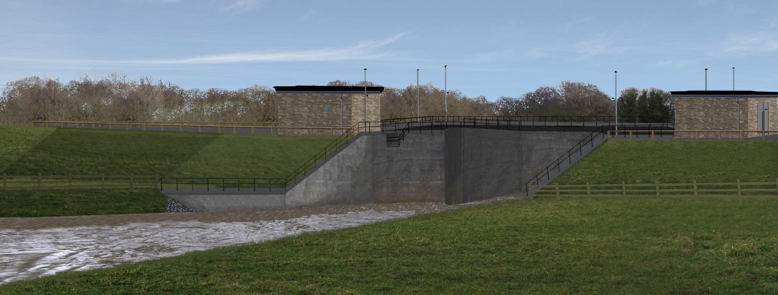
- Two new control structures at the downstream and upstream end of the site – during normal flow conditions these will remain open, allowing a consistent water flow. When the river levels become too high the sluice gates will close, so that the museum is protected from flood water
Below you can see an artist's impression of how the two flow control structures will look:


Flood defence work at Armley Mills is expected to complete in early 2024.
Completed Works
Installation of the Milford Place Pipe Bridge
- A narrow-gauge railway has been removed from the works area
- In March/April 2022 we carried out vegetation management works on the island. Amendments were made to the original plans for these works to retain as many trees as possible on the North side of the island. Other vegetation was coppiced, rather than removed entirely, to encourage regrowth and retain habitat.
- In April 2022 we established a 1000 tonne crane in the Cardigan Trading Estate car park, over two days. We then used this to lift two smaller crawler cranes over the river to the Armley Mills island, which was necessary due to lack of road access.
- In late June we dismantled the boiler room extensions and removed damaged sections of the locomotive shed roof ahead of objectives moves within the shed.
- After careful planning with the museum and heritage experts, we have successfully moved several artefacts on the island and inside the locomotive shed to allow for works to continue.
- A fish rescue was successfully carried out. We moved approximately 100lbs (45kg) of live fish from the goit into the river. These included carp, chubb, grayling and minnows.
- As part of ongoing efforts to meet fuel and material reduction targets across our construction sites, we have installed a solar and hydrogen fuel cell-powered gatehouse. This new system is completely free of emissions, and is a great example of the various ways we are mitigating the environmental impact of construction.
- We successfully have installed the Milford Place Pipe Bridge, connecting utilities and other services from the Leeds Industrial Museum to Milford Place - Visible from Canal Road and the Milford Place footbridge, this pipe bridge features ten steel silhouettes of mill workers, a nod to the museum’s industrial heritage
Current and upcoming works
Progress on flood walls behind the drying shed
- All concrete blocks have been removed from the river by the drying range, with cladding and installation of coping stones on the wall here ongoing.
- Concrete works within the locomotive shed are complete, with installation of glass panels ongoing.
- Gates and flap valves have been installed on both the upstream and downstream flow control structures.
- We have successfully removed both cofferdams (dry working environments) on the downstream and upstream flow control structures, and have begun to clear the goit areas of construction materials.
- Works to install a new and improved ramp onto Buffalo Bill Bridge are also progressing well.
Page last updated 27/3/24
Zone 12b – Viaduct Road to Redcote Lane Bridge
Overview
Works in zone 12b include building concrete flood defence walls cladded with material appropriate for the area.
This area contains Cardigan Fields Leisure Park, where our flood defence works are sensitively being incorporated into a new public realm design, while keeping the new children’s play area. In the below before and after slider, you can see how the site looks as of January 2022:


Completed works
 Raised planters at Cardigan Fields made using 3D printed concrete
 Flood wall near to Evanston Avenue
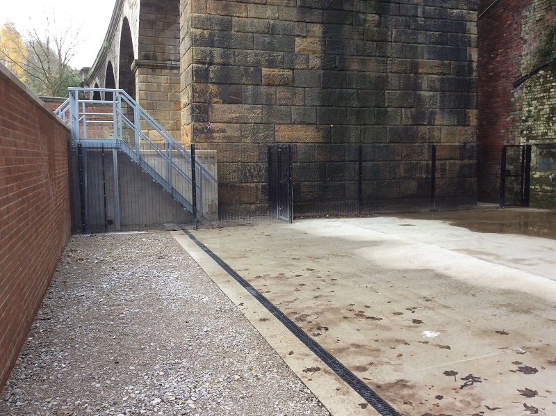 Completed works at Kirkstall Viaduct
- We have finished our flood defence walls at Cardigan Fields Leisure Park
- The landscaping features on the site include new public seating and are made from 3D printed concrete. This saved production time, removed the need for shuttering and reinforcement and was a considerable carbon saving
- A New flood wall off Evanston Avenue is now completed
- Works on Milford Place Footbridge are now complete – the bridge reopened on May 20 2022
- We have created an access track, temporary causeway and scour protection to enable our works to the riverbank under the viaduct by Viaduct Road
- Works under the Kirkstall Viaduct are now complete. The access track to the flood defence has been secured by fences and gates, and the area has been handed back to the landowner.
- We have successfully reinstated the car park on Milford Place industrial estate and have handed back to the businesses located there.
Page last updated 29/2/24
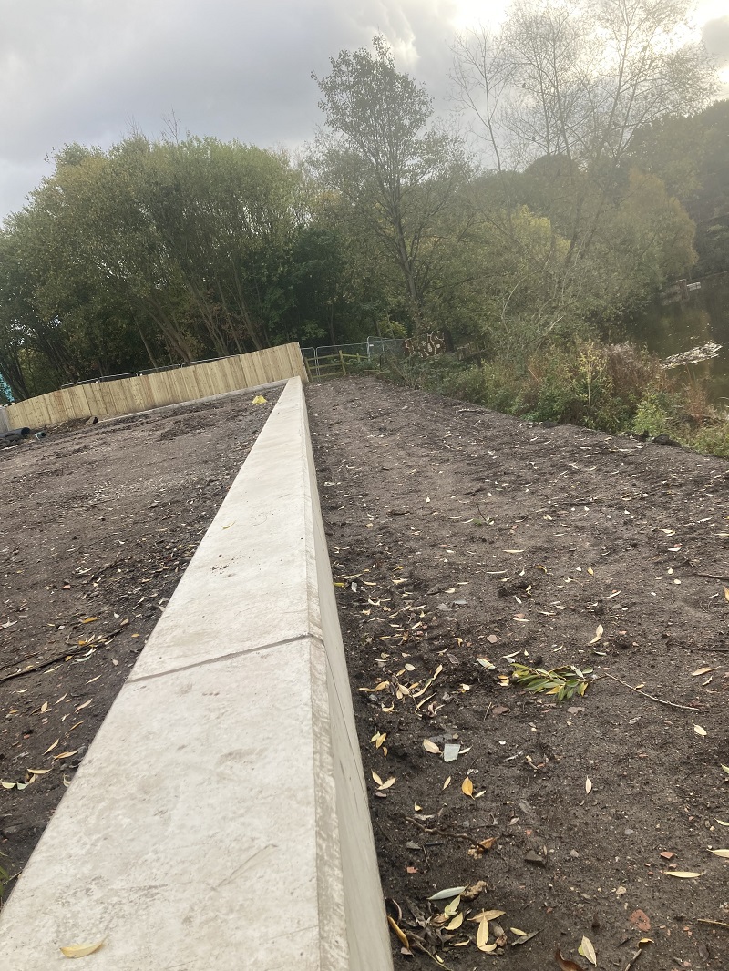
Zone 12c – Redcote Lane Bridge to Kirkstall Valley Nature Reserve
Overview
Works in zone 12c run further along Kirkstall Road, behind ASDA and the Home Office Site. We will build flood defence walls, plant more trees and create two flow control structures across the goit upstream and downstream of the Home Office as well as a new pumping station.
The flow control structures will have a penstock which will be operated in a flood event to restrict the flow entering the goit.
Work has already started and will complete in early 2024.
Completed works
Completed flood walls at the substation off Redcote Lane 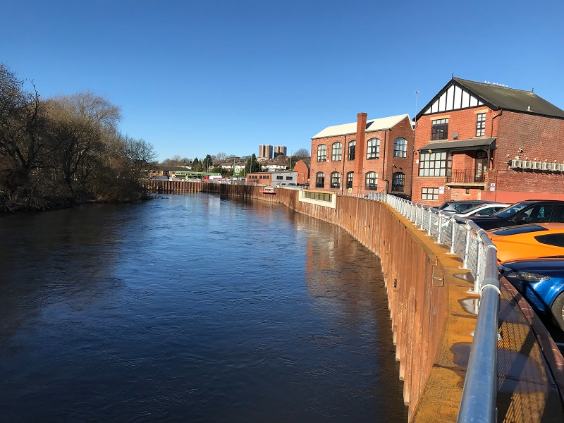
Completed walls and glass panels at Airedale House
- We have now completed the installation of sheet piles in this area. Throughout this process we reduced disruption where possible by regularly communicating with residents and businesses and changed our working hours through the week, or over weekends
- Work at the Redcote Lane substation is now complete, meaning we have established our first flood cell to a 1-in-100 year level of protection. This is particularly significant as this site powers thousands of homes across West Leeds, and is vital to the livelihoods and wellbeing of the people we seek to protect from flooding
- Works at Airedale house are substantially complete, with only minor finishing works remaining. The works here include the use of glass panels
Current and upcoming works
 Completed pipe works at the pumping station behind the Home Office
- Works are largely complete, with mechanical and electronic works to the pumping station behind the Home Office building on Kirkstall Road continuing.
- Once levels in Burley Goit recede a trash screen will be installed on the inlet of the flow control structure.
Page last updated 27/3/24
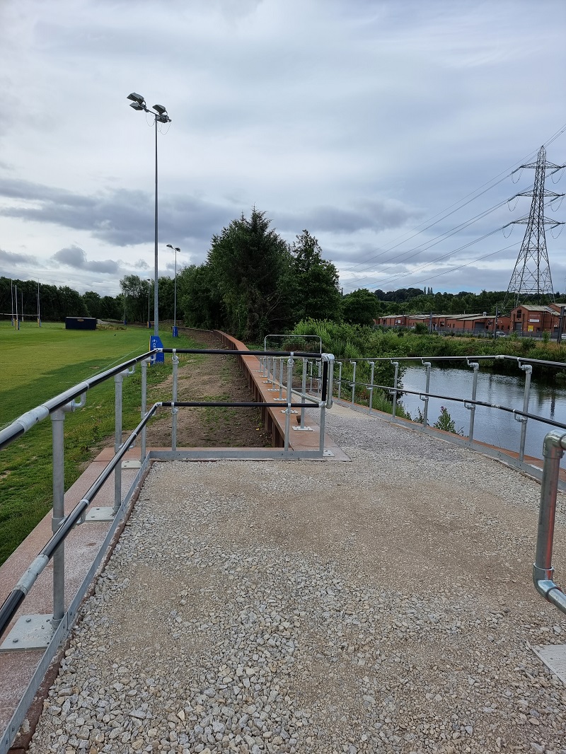
Zone 12d – Kirkstall Valley Nature Reserve to Kirkstall Bridge
Overview
In zone 12d, flood defences will line the left and right bank of the river along the railway line and the Leeds Rhinos Rugby Club training ground.
Access to the river from the Canoe Club will be upgraded with a new canoe ramp and platform which can be used by the public to enjoy the use of the river.
Continuing down the left bank, the flood defence will continue into the old Saint Anne’s Mill area with the public footpath leading around the river being maintained for public use. On the right bank of the flood defence at Saint Anne’s Mill is Kirkstall Valley Nature Reserve which isn’t included as part of the flood defence scheme, but is subject to further funding proposals in the future to enhance the area including creating new footpaths to improve access.
Construction started in summer 2021 and is aimed to be complete by Spring 2024.
Completed works
 Completed sheet piling by Kirkstall Training Ground
- Detailed designs of flood defences were developed in autumn 2020
- All works by the Kirkstall Training Ground have been completed and we have vacated the site
Current and upcoming works
- Works on the pumping station on Wyther Lane continue. The maintenance kiosk and other mechanical and electrical components have been delivered, and we are working closely with our contractors to install them.
Page last updated 27/3/24
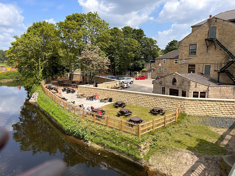
Zone 13a - Kirkstall Meadows
Zone 13 covers Kirkstall Bridge along with the Kirkstall Bridge Inn and Kirkstall Bridge Retail Park, up through Kirkstall Meadows, Kirkstall Abbey up to Newlay Bridge, this area has a mixture of uses, for business, retail, leisure and areas of significant historical importance.
Overview
In zone 13a on the left bank, our works will replace the flood defence wall, reinstate the gardens and block underground seepage paths at the Kirkstall Bridge Inn which was impacted by the floods on Boxing Day 2015.
Works are also to be conducted in Kirkstall Meadows. We will be making landscape and ecological enhancements across 2.4 hectares including the creation of wetland scrapes and a kingfisher and sandmartin bank. It is currently planned that the wetland habitat will be inaccessible to the public to minimise disturbance. The existing sports pitches will be retained.
The flood defence within this area consist of an embankment that runs along the back of Kirkstall Meadows to protect the railway line, the new embankment will tie into new walls that extend up to the existing Kirkstall bridge.
No flood defence works are proposed for Kirkstall Forge as part of this scheme.
Completed works
Completed works at the Kirkstall Bridge Inn
- We have carried out ground investigation works at Kirkstall Meadows to understand ground conditions there and how they will affect our permanent flood defence works.
- Works in this zone began on the 8th of August 2022
- Removal and excavation of the old wall at Kirkstall Bridge Inn is complete, allowing for the car park to be reopened.
- We have installed scour protection along the riverbank, which will protect the new flood defence wall.
- Working closely with Network Rail, we have dismantled the ramp off Kirkstall Bridge. This will be replaced with a new ramp, allowing for improved access to Kirkstall Meadows
- We completed our major works in the beer garden at the Kirkstall Bridge Inn, this site has now been handed back
- We have completed the 1.4km earth embankment on Kirkstall Meadows, that will protect the railway line from flooding
Current and upcoming works

Works to Kirkstall ramp
- Works to the wetland habitat on Kirkstall Meadows are nearing completion. We have planted a variety of trees and shrubs at this location, as well as creating habitats for wildlife here.
- All three sections of the new ramp from Kirkstall Bridge to Kirkstall Meadows have successfully been lifted and installed.
Page last updated 27/3/24
Zone 13b – Kirkstall Abbey
Overview
Kirkstall Abbey is classified as a Scheduled Monument, which legally protects it against unauthorised change. Fortunately, the ground height of the Abbey is above the threshold for any flood alleviation works, and there are minimal works being undertaken within the Kirkstall Abbey conservation area as a result of this scheme, although more significant works are being undertaken in the surrounding areas.
We are planning to build a new control structure across the entrance of the goit and in front of Kirkabbey Sluice Gates which will tie into the listed weir. This will limit the volume of water during high river level conditions. This has been designed to ensure that the structure complements the sensitive historic environment in which it is situated, and the existing sluice gates and gate house will be retained. The structure will also be a walkway that could provide additional amenity facilities for visitors to the site and potentially open up new views.
These works will also facilitate the ability for the community aspiration to improve the flow of the goit in this area.
Completed works
- In summer 2020, we carried out ground investigation works at Kirkstall goit, the location of our proposed flow control structure. The work involved removing silt for inspection.
- We also carried out ground investigations at Kirkstall Abbey, which helped to inform the next stage of delivery. To do this work, and to protect and minimise disruption to species in the river, we led a fish rescue. We successfully relocated chub and gudgeon.
- We have completed and submitted our designs for approval. We’re talking to affected residents and businesses in this zone, so that they are informed of developments.
- The site working area has been successfully installed, along with tree protection and a temporary causeway and haul road. We have installed crane mats and ramped access to the site.
- Ground investigation works have been undertaken to determine the foundations under Kirkstall Weir and Clough House.
Current and upcoming works
 New flow control structure at the inlet of Kirkstall Goit
- The sheet piles that formed the cofferdam (dry working area) around the flow control structure have been removed, and the working platforms are now being excavated to restore the original ground level.
- Landscaping and reinstatement works will follow in the coming weeks. We expect to complete works at this site in May.
Page last updated 27/3/24
Zone 13c – Newlay Bridge
Overview
There will be a combination of remedial building works, flood defence walls and sheet piling which will be clad in stone, so it is in keeping with the conservation area. Works will also be sympathetically undertaken due to the listed bridge in Newlay, in line with the Listed Building Consent.
Completed works
- After the collapse of the weir at Newlay Bridge and the subsequent scouring that has occurred following the drop in river levels, we have conducted regrading and profiling of the existing bank that has slipped into the river placed approximately 1000 tonnes of rock and stone to prevent further scouring until permanent works start. These works will be incorporated into our permanent flood defence works in the area
- We have completed the causeway in the river channel. This will allow us to access the properties along the riverbank, where we will be constructing our flood defences
- we have installed information boards in the area to describe our works in Newlay, as well as provide more general information about the scheme
Current and upcoming works

Works on the flood defence walls in Newlay
- We are continuing with works to reinstate the dry side the flood defence walls along the left bank.
- We have begun works to remove the temporary causeway that was installed in the river channel to enable access to the wet side of the wall.
- Works to install rock scour are also ongoing.
Page last updated 27/3/24
Zone 14 – Flood Storage Area
Overview
Between the Horsforth Vale housing development and Cragg Wood, we are building a flood storage area. This will play an integral part in increasing the standard of protection downstream in Leeds to 1-in-200 years, including an allowance for climate change.
The flood storage area will be operated by a flood control structure consisting of two large floodgates and a 200m embankment with a maximum height of 6.2m above existing ground level. This structure will operate automatically to reduce the volume of river water heading downstream in flood conditions over the 1 in 100-year threshold. The flood storage area can hold up to 1,800,000m3 of water when the river levels are high and then slowly release it back into the river when it is safe to do so.
The below mock ups show how the completed storage area will look before and during a flooding event:
The below video showcases how the storage area will work during high river levels:
The flood storage location is mostly rural, with areas of woodland to the north and south. As part of our work, we will create habitat and wildlife areas in the surrounding area.
Completion of the structure and embankments either side is expected for Spring 2024.
Completed Works
- Planning was approved in May 2021 and construction of the access track started immediately after
- The site compound, office and welfare facilities were established in September 2021
- After this works commenced on diverting the existing river channel and construction of a temporary crane platform
- In September 2021 installation of temporary works to facilitate construction of the flow control structure of the flood storage area commenced and will continue into 2022
- In order to construct the control structure, a temporary cofferdam (dry working area) was completed in January 2022
- We have completed a brook diversion on site. Planting around this area has been completed, and slopes have been hydroseeded with a wildflower grass mix.
- The causeway adjacent to the cofferdam has also been completed. This will allow access to the right bank of the river so that we can complete work there, including protection works to the nearby gas main.
- In December we began to extract sheet piles from around the cofferdam, allowing the river to flow back into the working area watch here:
- This is a significant achievement for the scheme, as the diversion of the river through the structure allows us to begin considering the sequence of works which will ensure the flow control structure will function in late 2023.
- We have now successfully removed all the sheet piles from the cofferdam (dry working area), which will be reused in other areas of our works.
- Works to bring the north and south embankments on either side of the control structure to level are now complete. This means the river now flows through the structure.
- The North and South gates have now both been successfully delivered and installed.
- We have completed works to tie in the south embankment to the embankment along the railway line. These works included the construction of an imprinted concrete flood wall, scour protection along the riverbank, as well as installation of palisade fencing.
- We have successfully installed both gates of the flow control structure, complete with mechanical and electronic elements. Following this milestone, we were able to remove the stop logs from the south side of the structure last week.
Current and upcoming works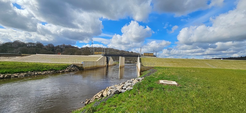 Works to the embankment at the flood storage area
- Works to the control room building for the flow control structure continue, with contractors on site to complete the electrical works, connecting the components to the mechanisms of the gates within the structure.
- A further kiosk is being installed by Calverley Bridge, to monitor river levels and feed into the mechanism for operating the flow control structure within the flood storage area.
Page last updated 27/3/24
Zone 15 – Apperley Bridge
Overview
Our work at Apperley Bridge will include engineered flood defences downstream from the entrance at Bottom Farm to Woodhouse Grove School. Our works will include flood walls, embankments and a pumping station. Minor works are required on Carr Beck to ensure that we do not increase flood risk to the area.
An artist's impression of how a flood defence wall on Apperley Road will look
Planning was approved in May 2021, construction began in 2022 and is aimed to be complete in Spring 2024.
Completed works:
The reopened Grade II listed Apperley Lane Bridge

The reinstated section of Apperley Road by the George and Dragon pub
- An Inspection for bats and also to investigate the structural integrity of Apperley Lane Bridge was successfully conducted in January 2022
- Our site compound was completed in May 2022
- We’ve installed information boards about the scheme outside the compound, should residents wish to understand more about our works
- We have completed the sheet piling between Apperley Lane Bridge and the Stansfield Arms pub
- At Woodhouse Grove School, we have completed reinstatement works to protect the Pavilion building. We have removed the temporary fencing on this site, and reopened the public right of way.
- We have completed the sheet piling between Apperley Lane Bridge and the Stansfield Arms pub.
- Works at Woodhouse Grove School are now complete, with only snagging works remaining.
- Works at Bottom Farm are now complete, with only snagging works remaining.
- We successfully reopened the Grade II listed Apperley Lane Bridge to all road users on the 24th of August 2023.
- Work to the flood defence wall on the left bank by the bike shop on Apperley Lane is complete, with fencing installed.
- The flood wall along Apperley Road is complete.
- We have completed resurfacing works on Apperley Road, between Apperley Lane bridge and Harrogate Road bridge, with the original access to the car park of the George & Dragon pub also reinstated.
Current and upcoming works:
- The flood defence wall on the right bank behind the properties on Parkin Lane, Waterloo Crescent and Tomlin Well Lane is also nearing completion, with garden reinstatement works ongoing.
- We are liaising with residents in the area to also update them on timescales for reinstating the road on Parkin Lane and Waterloo Crescent, ensuring that access to properties is retained.
- Last week, we began to install drainage at the bottom of Calverley Cutting, which will capture surface water and direct it to the pumping station to be pumped out into the river. A raised kerb has also been installed at the entrance to Waterloo Crescent, so any other water that is captured can be directed away from the cul-de-sac. We have carried these works out at night, so as to avoid restricting access for local traffic, and expect these works to be completed today (28 March), with traffic management removed tomorrow morning.
Page last updated 28/3/24
Apperley Bridge traffic management update - Reviewed 28/3/2024
In order to link the drainage network to the new pumping station by the George and Dragon pub, we will need to manage traffic around Apperley Road and Harrogate Road. The majority of the drainage work will be beneath ground level in the pub car park, along Apperley Road, across Harrogate Road and into Parkin Lane. There will be a small adjacent kiosk above ground in the pub car park, which will contain electrical control equipment.
We will be undertaking a phased approach, where the road layout will change over a six month period to enable our works. Here is a summary of key dates:
| Phase/event | Status/ Dates |
| Reopening of Apperley Lane Bridge | Complete |
| Closure of Apperley Road between Apperley Lane Bridge and Harrogate Road Bridge | Complete |
| Phase 1 | Complete |
| Phase 2 | Complete |
| Phase 3 | Complete |
| Phase 4 | Complete |
| Phase 5 | 29 March (expected) |
| Reinstatement works adjacent to the George & Dragon | Complete |
| Reopening of Apperley Road | Complete |
| Completion of pumping station | Late April 2024 |
More detail of each phase of works is included below.
While some disruption is inevitable, we are minimising this as far as possible and are working closely with the local highway authority.
The constrained nature of the area and complex nature of the works mean that some changes to the dates or details are likely. If this happens, we will update the community of any significant changes in advance, and keep this webpage up to date.
We apologise for the inconvenience this may cause over the next few months, and thank you in advance for your patience.
Works to Date (22/3/24)
On Thursday 24 August, we successfully reopened the listed Apperley Lane bridge to all road users, marking the start of the complex sequence of drainage works across Apperley Road, Harrogate Road, Parkin Lane, and Waterloo Crescent.
The reopening of the bridge meant we could begin works on the drainage and flood defence wall along the small section of Apperley Road between Apperley Lane bridge and Harrogate Road bridge. In order to retain access to the George & Dragon car park, we created a new access point to the west of the existing one. Traffic between Apperley Lane bridge, Apperley Road and the car park is being managed by a three-way traffic light system. This arrangement will be in place until this section of Apperley Road is reopened in February 2024.
We are undertaking a phased approach to the drainage works, the phases now complete are:
- Phase 1 - involved the temporary occupation of a small section of the northbound lane and filter lane on Harrogate Road, by the junction between Apperley Road and Harrogate Road. We successfully completed works along this section on 16 October.
- Phase 2 - involved the temporary occupation of a corner of the southbound lane and filter lane on Harrogate Road and eastbound lane into Parkin Lane. We successfully completed this phase of works on 31 October.
- Phase 3 - involved the occupation of a corner of the southbound lane and filter lane on Harrogate Road and westbound lane out of Parkin Lane. We successfully completed this phase of works on 8 November.
- Phase 4 - involved the occupation of a section of the eastbound lane on Parkin Lane, as well a section of the southbound lane on Harrogate Road. We successfully completed this phase of works on 17 November.
- Phase 5a involved working in 20 metre sections of the eastbound lane of Parkin Lane, up to Waterloo Crescent. During this phase, all temporary traffic restrictions on Harrogate Road and Parkin Lane were removed, with priority given to traffic turning in from Harrogate Road. This phase lasted until late January 2024.
- Phase 5b involved night time works around Calverley Cutting. The final works are expected to finish on 28 March 2024.
- Reinstating the section of Apperley Road and the original access to the George and Dragon pub required temporary traffic lights by Apperley Lane Bridge, and on Harrogate Road. These works were completed on 28 March 2024.